Public record · 14-day delayAbout our data
229 Carl Vinson Pkwy, Warner Robins, GA 31088-5815 · Houston County
No outcome reported · Sale date November 3, 2026 · no outcome reported
Subscribers get the latest updates, owner information including mailing address, tax card links, and the option to create instant property alerts.
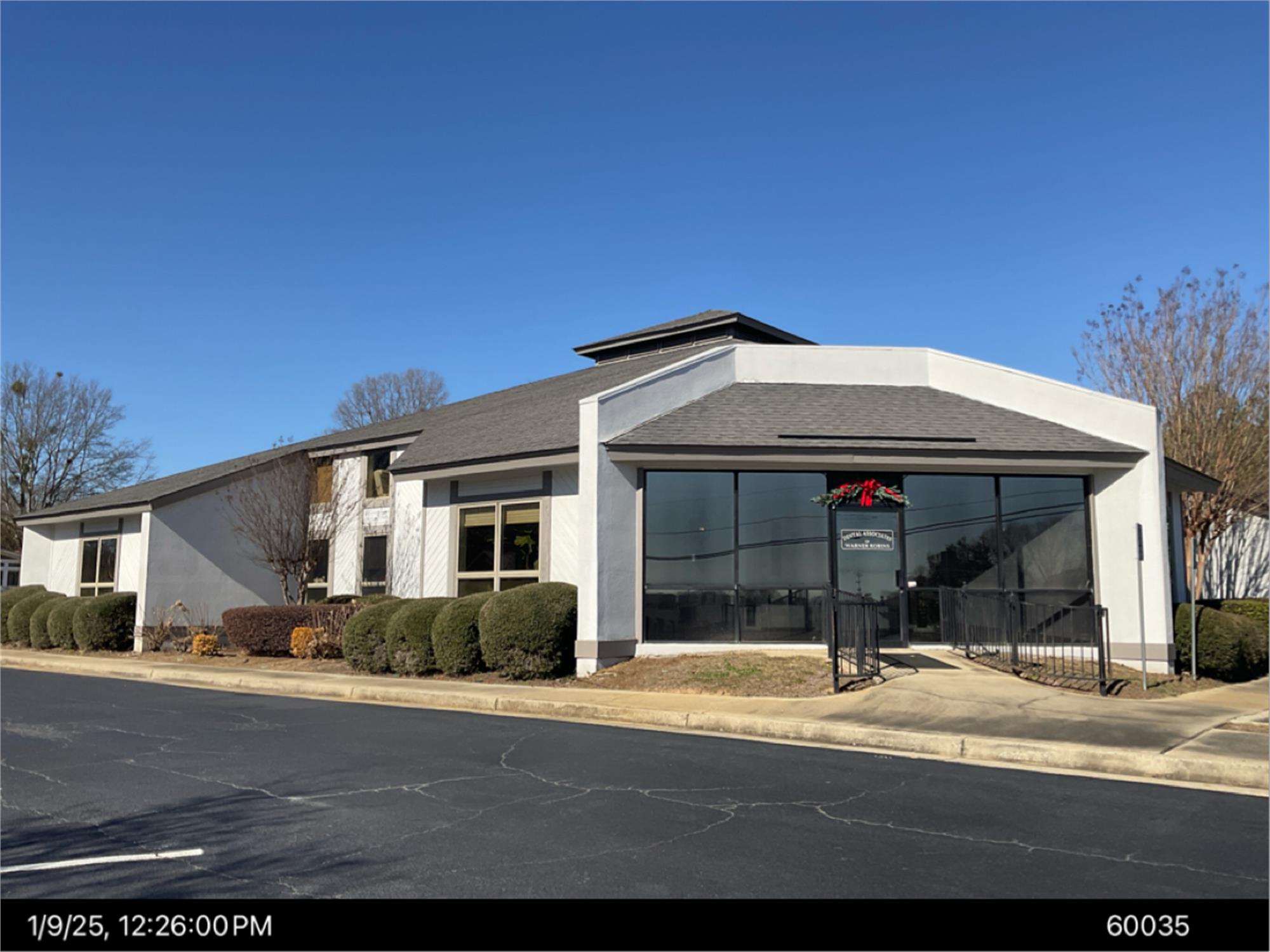
Loading Street View...
For this property only. Prepared by our title team and emailed to you.
These are example numbers, not this property's. Change them to see how the math works.
Profit as a percentage of the total cost of the deal, earned over the 180-day hold. Not a yearly rate.
Change any number and watch your max bid update.
Maximum bid for this example
$165,183
The most you could pay and still make 20% after every cost below. Higher repairs or a higher target bring it down.
Locked for this example. Subscribers can edit every one of these.
"Foreclosures" 1635 "" 115502 "26-1455 NOTICE OF SALE GEORGIA, HOUSTON COUNTY By virtue of a power of sale contained in that certain Security Deed from CONDO OH, LLC to AMERIS BANK, dated October 9, 2020, and recorded in Deed Book 8810, Page 264-271 et seq., in the Office of the Clerk of Superior Court of Houston County, Georgia, said Security Deed having originally been given to secure that certain Promissory Note in the original principal amount of EIGHT HUNDRED NINTY SIX THOUSAND AND 00/100 DOLLARS ($896,000.00) of even date therewith, as well as all extensions, renewals and modifications thereof, together with any and all other indebtedness, of any type or description, then or thereafter owing by CONDO OH, LLC to AMERIS BANK, there will be sold by the undersigned, at public outcry, to the highest bidder for cash, before the courthouse door at Perry, Houston County, Georgia, within the legal hours of sale on the first Tuesday in November, 2026 being November 3, 2026, the following described property: All that tract or parcel of land lying and being in Land Lot 142 of the 5th District, Houston County, Georgia, and within the city of Warner Robins, Georgia, containing approximately 0.82 acres and being shown on that certain survey entitled “ALTA/NSPS Survey For: Condo OH LLC, Ameris Bank, Hargett Properties, LLC, Powell & Edwards, Attorneys at Law P.C., and Chicago Title Insurance Company”, prepared by Story Clake & Associates, bearing the seal and certification of Michael L. Clarke, Georgia Registered Land Surveyor No. 2865, dated September 11, 2020, and being more particularly described as follows: Begin at a point marked by an iron pin found at the intersection of the westerly right-of-way line of Carl Vinson Parkway (having a 130-foot right-of-way) with the northerly right-of-way line of Catalina Drive (having a 50-foot right-of-way), said point being the TRUE POINT OF BEGINNING; from said TRUE POINT OF BEGINNING, run thence along said northerly right-of-way line of Catalina Drive South 89 degrees 55 minutes 48 seconds West a distance of 197.15 feet to a point marked by an iron pin found; thence leaving said right-of-way line, run North 00 degrees 04 minutes 12 seconds West a distance of 179.98 feet to a point marked by an iron pin found; run thence North 89 degrees 55 minutes 48 seconds East a distance of 199.55 feet to appoint marked by an iron pin found on the westerly right-of-way line of Carl Vinson Parkway; run thence along said westerly right-of-way line of Carl Vinson Parkway South 00 degrees 41 minutes 34 seconds West a distance of 180.00 feet to appoint marked by an iron pin found, said point being the TRUE POINT OF BEGINNING. THE STREET ADDRESS OF THE ABOVE-DESCRIBED PROPERTY, UPON INFORMATION AND BELIEF OF AMERIS BANK ACCORDING TO THE PRESENT NUMBERING SYSTEM OF STREETS IN HOUSTON COUNTY, GEORGIA IS 229 CARL VINSON PARKWAY, WARNER ROBINS, GA 31088. The indebtedness secured by the aforementioned Security Deed has been and is hereby declared immediately due and payable in full because of the failure of CONDO OH, LLC to maintain payments upon said indebtedness owing to the AMERIS BANK in accordance with its terms. Said indebtedness remaining in default, this sale shall be made for the purpose of paying such indebtedness, as well as all expenses of this sale, including attorneys' fees. The above-described property will be sold as the property of CONDO OH, LLC and will be sold subject to the following items which may affect the title to said property: all zoning and subdivision ordinances and/or regulations; matters which would be disclosed by an accurate survey or an inspection of the property; all real property ad valorem taxes or assessments, which may constitute liens upon said property; all liens which, under applicable law, would take priority over the Security Deed described above; and all easements, restrictions, rights-of-way, security deeds or other encumbrances of record which have priority over the referenced Deed to Secure Debt. To the best of the knowledge and belief of the undersigned, the party presently in possession of said property is CONDO OH, LLC, and/or a tenant or tenants. Please be further advised that the entity which has full authority to negotiate, amend and modify all terms of your Notes, Security Deed, and related documents, is: Ameris Bank 285 South Broad Street Ellaville, GA 31806 (904) 292-3718 ATTN: Jim Owler, Senior Vice President Please note, however, that such entity or individual is not required by law to negotiate, amend or modify the terms of such loan. THIS LAW FIRM IS ATTEMPTING TO COLLECT A DEBT AND ANY INFORMATION OBTAINED WILL BE USED FOR THAT PURPOSE. AMERIS BANK, as Attorney-in-Fact for CONDO OH, LLC MOORE, CLARKE, DuVALL & RODGERS, P.C. D. BRADLEY FOLSOM Attorneys for AMERIS BANK Post Office Box 4540 Valdosta, Georgia 31604-4540 (229) 245-7823 PUBLICATION DATES: October 7th, 14th, 21st and 28th, 2026 64756 10/7-10/28" End of ad
Recorded from 1 source. First recorded October 7, 2026. Record as of November 6, 2026. About this data & licence
Subscribers see this record 14 days earlier, plus the owner of record and mailing address.
Title Reports need only a free account.