Public record · 14-day delayAbout our data
1769 Cheshire Bridge Rd Ne, Atlanta, GA 30324-4921 · Fulton County
Cancelled · Was scheduled for November 3, 2026
Subscribers get the latest updates, owner information including mailing address, tax card links, and the option to create instant property alerts.
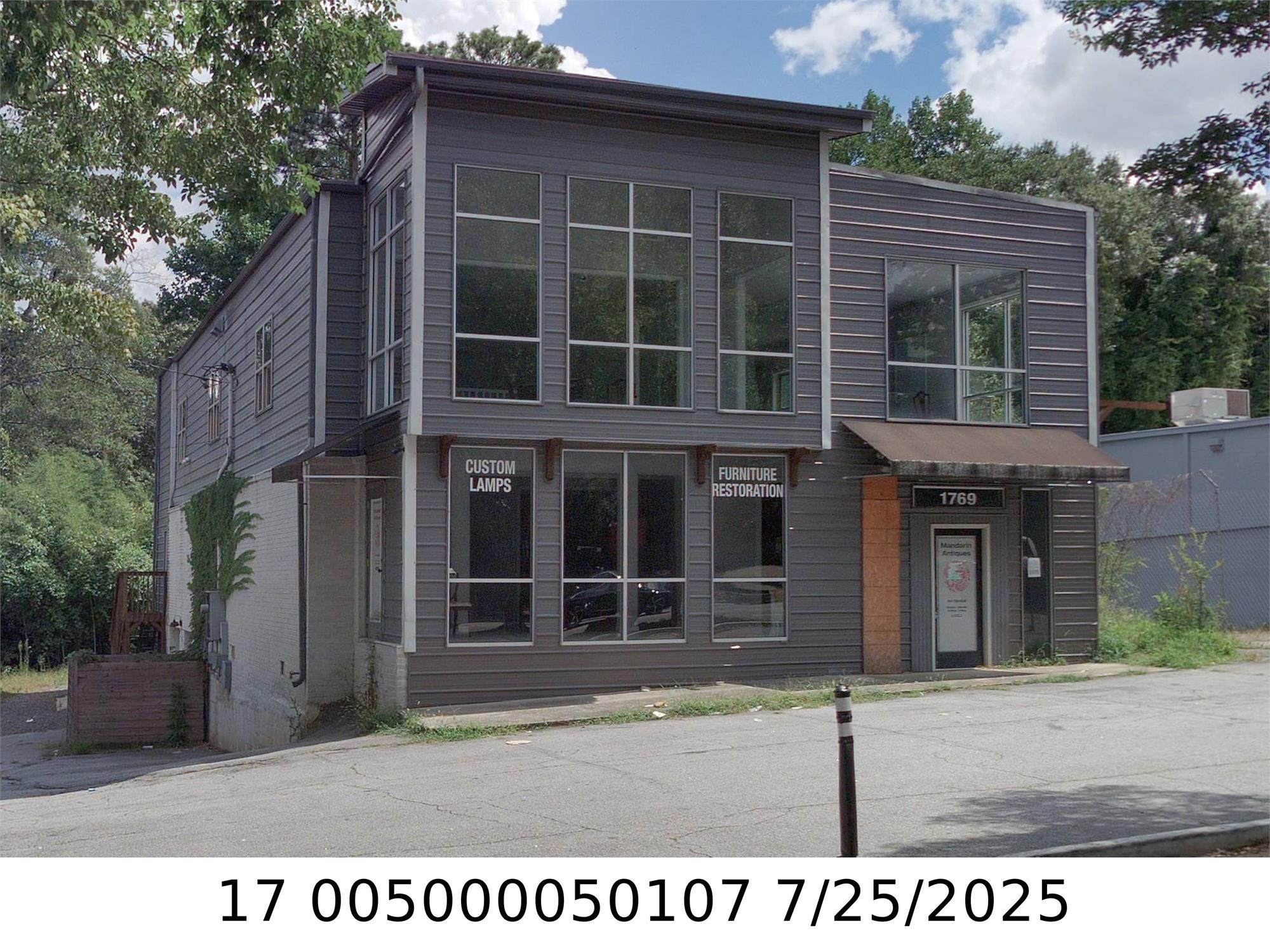
Loading Street View...
For this property only. Prepared by our title team and emailed to you.
These are example numbers, not this property's. Change them to see how the math works.
Profit as a percentage of the total cost of the deal, earned over the 180-day hold. Not a yearly rate.
Change any number and watch your max bid update.
Maximum bid for this example
$165,183
The most you could pay and still make 20% after every cost below. Higher repairs or a higher target bring it down.
Locked for this example. Subscribers can edit every one of these.
NOTICE OF SALE UNDER POWER FULTON COUNTY, GEORGIA By virtue of the Power of Sale contained in that certain Deed to Secure Debt and Security Agreement from Buckhead Business LLC ("Grantor") to Paces Funding, LLC dated November 25, 2025 and recorded in Deed Book 69896, Page 156, Fulton County, Georgia records ("Security Deed"), being given to secure a Promissory Note in the original principal amount of THREE MILLION SIX HUNDRED NINETY-SEVEN THOUSAND AND 0/100 DOLLARS ($3,697,000.00) (the "Note"), with interest thereon as set forth therein, there will be sold by the undersigned at public outcry to the highest bidder for cash before the courthouse door at Fulton County, Georgia, within the legal hours of sale on the first Tuesday in November 2026 the following described real property (the "Property"): All that tract or land lying and being in Land Lot 50 of the 17th District of Fulton County, Georgia, being Lots 6 and 7 of the subdivision of W. E. Worley Property as per plat recorded in Plat Book 23, Page 41, Fulton County Records, and being more particularly described as follows: BEGINNING at an iron pin at the intersection of the southeastern side of Cheshire Bridge Road (as said road is now located and same having an eighty foot right of way) with the southwestern side of Windemere Drive (formerly Oakland Circle) as same is now located (said Windemere Drive having a fifty foot (50) right of way); thence running in a southwesterly direction along the southeastern side of Cheshire Bridge Road 123 feet to an iron pin; thence running in southeasterly direction along the northeasterly line of Lot 8 of said subdivision 185.4 feet to the northwesterly side of a 10 foot alley; thence running in a northwesterly direction along the northwesterly side of said 10 foot alley, 113 feet to an iron pin on the southwesterly side of Windemere Drive, thence running in a northwesterly direction along the southwesterly side of Windemere Drive 185 feet to the point of beginning. LESS AND EXCEPT THE FOLLOWING TRACT: TO FIND THE TRUE POINT OF BEGINNING, Begin at an iron pin located at the intersection of the Southeasterly right of way of line of Cheshire Bridge Road (said road having a 80 foot right of way) and the southwesterly right of way line of Windemere Drive a/k/a Oakland Circle (said road having a 50 foot right of way); running thence South 68 degrees, 47 minutes 25 seconds West along the southeasterly right of way line of Cheshire Bridge Road a distance of 68.00 feet to an iron pin and the TRUE POINT OF BEGINNING; from said true point of beginning, running thence South 22 degrees 37 minutes 40 seconds East 185.03 feet to an iron pin located on the northwesterly side of said 10 foot alley, running thence South 68 degrees 27 minutes 50 seconds West along northwesterly side of a 10 foot alley: northwesterly side of 10 foot alley, distance or 49.77 feet to an iron pin located at the southeast comer of Lot 8 of the W. E. Worley subdivision as per plat recorded at Plat Book 23, Page 41, in the Office or the Clerk of the Superior Cout1 of Fulton County, Georgia, which plat is incorporated herein by this reference thereto; running thence North 24 degrees 14 minutes 25 seconds West along the easterly boundary line of Lot 8 a distance of 185.52 feet to an iron pin located on the southeasterly right of way line of Cheshire Bridge Road; running thence North 68 degrees 47 minutes 25 seconds East along the southeasterly right of way line of Cheshire Bridge Road a distance of 55.00 fee to an iron pin and the TRUE POINT OF BEGINNING The above-described property is shown on and delineated according to that certain plat of survey for Good Samaritan Hospital Foundation by Wikle Land Surveying, Ron R. Wikle Jr., Georgia Registered Land Surveyor No. 2578, dated August 13, 1992. ADDRESS: 1769 CHESHIRE BRIDGE ROAD NE, ATLANTA, GEORGIA 30324 TIN: 17-0050-0005-010-7 The debt secured by said Security Deed has been and is hereby declared due because of, among other possible events of default, failure to comply with the terms of the Note. The debt is in default because it is past due. This sale will be made for the purpose of paying the same and all expenses of this sale, including attorney's fees (notice of intent to collect attorney's fees having been given). Said Property will be sold subject to any outstanding ad valorem taxes (including taxes which are a lien, but not yet due and payable), and to any assessments, liens, encumbrances, zoning ordinances, restrictions, covenants, or other matters of record which are or may be superior to the Security Deed set out above. Pursuant to O.C.G.A. ? 44-14-162.2, the entity that has full authority to negotiate, amend, and modify all terms of the above-referenced loan has been provided to the Grantor. To the best knowledge and belief of Grantee, the described Property is in the possession of Buckhead Business LLC d/b/a Seventeen69 Restaurant and Lounge, 180 Parking Solutions LLC, and/or other tenant(s) or occupant(s). Said Property is more commonly known as 1769 Cheshire Bridge Road NE, Atlanta, GA 30324. The sale will be conducted subject to (1) confirmation that the sale is not prohibited under the U.S. Bankruptcy Code, and (2) final confirmation and audit as to the status of the loan with the holder of the Security Deed. Paces Funding, LLC as Attorney-in-Fact for Buckhead Business LLC Rountree Leitman Klein & Geer, LLC Attn: David S. Klein, Esq. Century Plaza I 2987 Clairmont Road, Suite 350 Atlanta, GA 30329 Telephone: 404-584-1238 RLK File No. 09535 10:07,14,21,28,2026 #584330-EPRecorded from 2 sources. First recorded October 7, 2026. Record as of November 3, 2026. About this data & licence
Subscribers see this record 14 days earlier, plus the owner of record and mailing address.
Title Reports need only a free account.