Public record · 14-day delayAbout our data
491 Old Albany Rd, Cordele, GA 31015-5439 · Crisp County
No outcome reported · Sale date June 2, 2026 · no outcome reported
Subscribers get the latest updates, owner information including mailing address, tax card links, and the option to create instant property alerts.
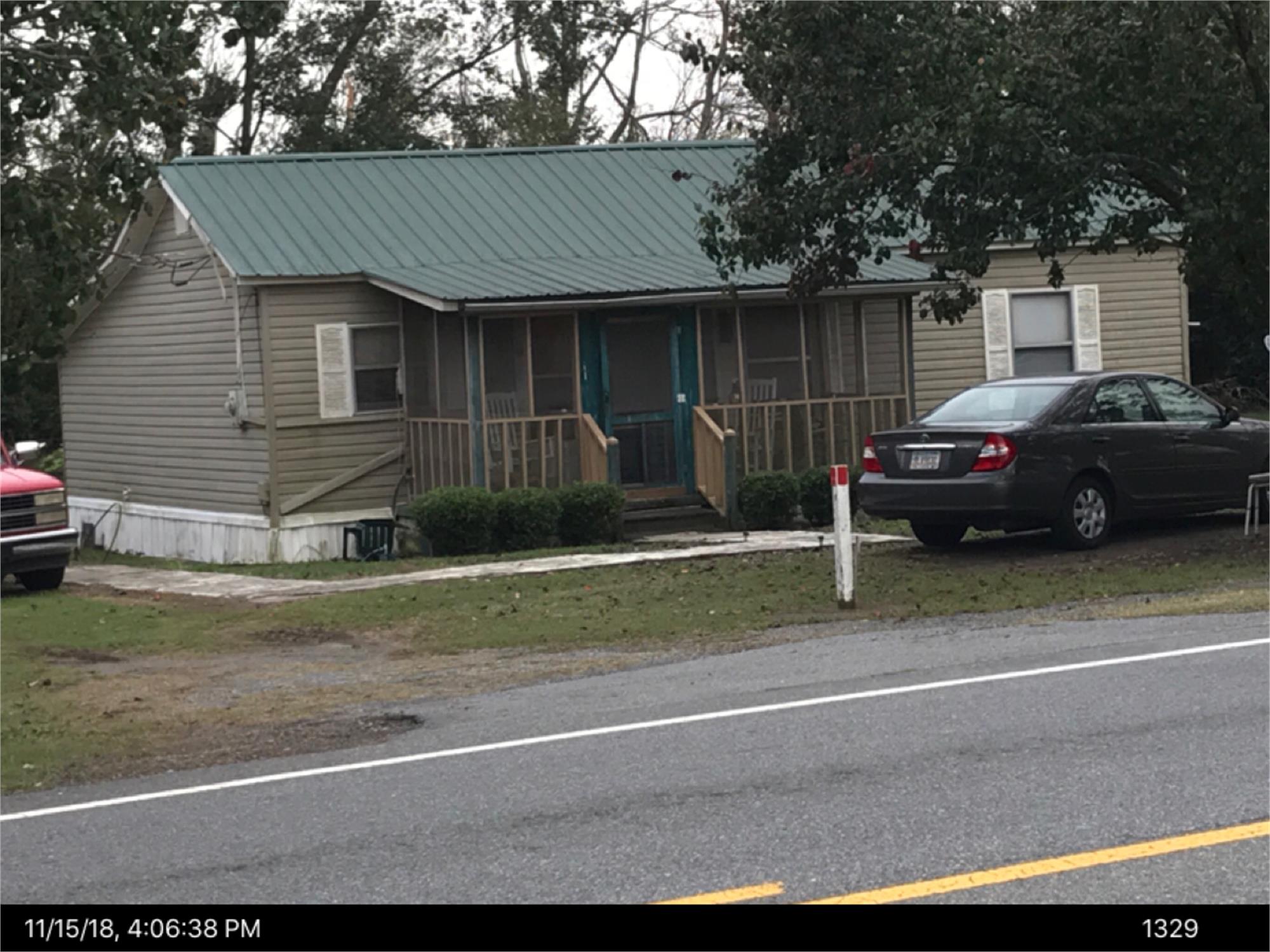
Loading Street View...
For this property only. Prepared by our title team and emailed to you.
An illustrative scenario from your assumptions, not an estimate for this property.
Profit as a percentage of the total cost of the deal, earned over the 180-day hold. Not a yearly rate.
Example values, not estimates for this property.
Maximum bid for this scenario
$165,183
The highest bid that still returns 20% on all-in cost under the assumptions below. Higher repairs or a higher target lower it.
Demonstration values, not typical costs or this property's. Subscribers set their own in the full worksheet.
PUBLIC NOTICE

NOTICE OF SALE UNDER
POWER
GEORGIA, CRISP COUNTY
Under and by virtue of the
Power of Sale contained in aSecurity Deed given by John ASmith, Regina F Smith toCitifinancial Services, Inc. datedMay 3, 2007, recorded in DeedBook 755, Page 38, CrispCounty, Georgia Records, and as modified by that certain Loan Modification Agreementrecorded in Deed Book 1205,Page 76, Crisp County, GeorgiaRecords, as last transferred to U.S. BANK TRUST NATIONALASSOCIATION, NOT IN ITSINDIVIDUAL CAPACITY BUTSOLELY AS OWNERTRUSTEE FOR RCAF ACQUISITION TRUST by assignment recorded in DeedBook 1200, Page 496, CrispCounty, Georgia Records,conveying the after-described property to secure a Note in theoriginal principal amount of FIFTY-NINE THOUSAND NINEHUNDRED FIFTY-SIX AND72/100 DOLLARS ($59,956.72), with interest thereon as set forththerein, there will be sold at public outcry to the highestbidder for cash before thecourthouse door of Crisp County, Georgia, or at such place as may be lawfullydesignated as an alternative,within the legal hours of sale onthe first Tuesday in June, 2026,the following described property:SEE EXHIBIT “A” ATTACHEDHERETO AND MADE A PARTHEREOF The debt secured by saidSecurity Deed has been and ishereby declared due and payable because of defaulthaving been made of the termsof the Note and Security Deed.The terms remaining in default, this sale will be made for the purpose of paying the total debt, including  all expenses of thissale, as provided in the Security Deed and by law which includes, but is not limited to, attorney’sfees (notice pursuant to O.C.G.A. § 13-1-11 having beengiven). Said property will be soldsubject to any outstanding advalorem taxes (including taxes which are a lien, but not yet dueand payable), the right of redemption of any taxingauthority, any matters which might be disclosed by anaccurate survey and inspection of the property, any assessments, liens,encumbrances, zoningordinances, restrictions, covenants, and any matters ofrecord including, but not limitedto, those superior to the Security Deed first set out above. Saidproperty will be sold on an “as-is” basis without anyrepresentation, warranty or recourse against the above-named or the undersigned. Prospective bidders must perform their own due diligence.U.S. BANK TRUST NATIONALASSOCIATION, NOT IN ITSINDIVIDUAL CAPACITY BUTSOLELY AS OWNERTRUSTEE FOR RCAF ACQUISITION TRUST is theholder of the Security Deed to the property in accordance withOCGA § 44-14-162.2. The entity that has full authorityto negotiate, amend, and modify all terms of the mortgage with the debtor is: Selene FinanceLP, 3501 Olympus Boulevard,5th Floor, Suite 500, Dallas, TX75019, 8777683759. Note, however, that such entityis not required by law to negotiate, amend or modify theterms of the loan. Upon information and belief,said property is more commonlyknown as 491 Old Albany Rd,
Cordele, GA 31015. Should a
conflict arise between theproperty address and the legal description, the legal description shall control. ATTENTION ALL PROSPECTIVE BIDDERS: OnMarch 1, 2026, the data collection and reportingrequirements under the U.S. Financial Crimes EnforcementNetwork (FinCEN) new Anti-Money Laundering Rule (the“Rule”), found at 89 FR 70258, went into effect. The Rule applies to certain residential real estate sale transactions (including some that go beyond the typical one-to-four family residence) where the transfer isto a legal entity or trust, and which includes cash purchases,private financing or financing provided by an institution notsubject to a federal Anti-MoneyLaundering or Suspicion ActivityReport requirement. If applicable, as part of this Rule,buyers and sellers are requiredto provide additional information and documentation about themselves, their legal entities,and/or the source of funds used in the reportable transaction. The collection of this informationand documentation is required to comply with the Rule’s federalreporting requirements, ifapplicable.* This notice isprovided for informational purposes only and does notconstitute legal advice. You areencouraged to consult with yourown independent legal counselif you have questions about how the FinCEN Anti-MoneyLaundering Rule affects yourtransaction and whether your transaction is reportable. *The Rule is the subject ofongoing litigation in severaljurisdictions. We suggest thatyou seek your own legal counsel if you have questions about the status of the Rule and its applicability to your sale, if any. The sale will be conductedsubject (1) to confirmation that the sale is not prohibited underthe U.S. Bankruptcy Code, (2) to final confirmation and audit of the status of the loan with theholder of the Security Deed, and (3) to confirmation that the successful bidder has timelyprovided all information requiredfor reporting under the Rule, 89FR 70258, if applicable. U.S. BANK TRUST NATIONALASSOCIATION, NOT IN ITSINDIVIDUAL CAPACITY BUTSOLELY AS OWNERTRUSTEE FOR RCAF ACQUISITION TRUST as Attorney in Fact for  John A Smith, Regina F Smith McCalla Raymer Leibert Pierce, LLP 1544 Old Alabama Rd Roswell, GA 30076 www.foreclosurehotline.net EXHIBIT “A” THE FOLLOWING DESCRIBED PROPERTY, TO-WIT:THAT CERTAIN TRACT OFLAND IN THE SHAPE OF ATRIANGLE LYING AND BEINGSOUTH AND EAST OF GEORGIA STATE ROUTE 257,BEING IN LAND LOT NUMBERONE HUNDRED FIFTY-FIVE(155), IN THE TENTH (10TH)LAND DISTRICT OF CRISPCOUNTY, GEORGIA, BOUNDED ON THE EAST BYLANDS OF DR. O. K.COLEMAN, TRUSTEE, ET AL; ON THE SOUTH BY LANDS OFR. M. MCKINNEY AND ON THE WEST AND NORTH BYGEORGIA STATE ROUTENUMBER 257. SAID TRACTBEING MORE PARTICULARLYDESCRIBED AS FOLLOWS:BEGINNING AT AN IRON PIPEON THE SOUTH AND EASTRIGHT OF WAY LINE OFSTATE ROUTE NUMBER 257AT ITS POINT OFINTERSECTION WITH THELANDS OF DR. O. K.COLEMAN, TRUSTEE, ET ALPROCEED THENCE IN ASOUTHERLY DIRECTIONALONG THE BOUNDARY TIME OF THE LANDS OF DR. O. K.COLEMAN, ET AL, FOR ADISTANCE OF 175.6 FEET TOAN IRON PIPE; THENCEPROCEED IN A WESTERLYDIRECTION ALONG THESOUTH LAND LOT LINE OFSAID LAND LOT NUMBER 155WHICH SAID SOUTH LANDLOT LINE CONSTITUTES THEBOUNDARY LINE WITH THELANDS OF R. M. MCKINNEYAND PROCEED THENCE IN AWESTERLY DIRECTION FORA DISTANCE OF APPROXIMATELY 235 FEETTO THE SOUTH AND EASTRIGHT-OF-WAY LINE OFGEORGIA STATE ROUTENUMBER 257; THENCEPROCEED IN A NORTHERLYAND EASTERLY DIRECTIONALONG THE SOUTH ANDEAST RIGHT-OF-WAY LINE OF GEORGIA STATE ROUTENUMBER 257 FOR ADISTANCE OFAPPROXIMATELY 285 FEETTO AN IRON PIPE WHICH ISTHE POINT OF BEGINNINGOF THAT TRACT HEREINDESCRIBED. SAID TRACT ISDESIGNATED AND SHOWNON PLAT OF SURVEY MADEFOR R. F. CULPEPPER ANDFERRELL KNOTT BY EARL D.RAINES, SURVEYOR, DATEDJUNE 30, 1971, RECORDED INPLAT RECORD 1, PAGE 232,IN THE OFFICE OF THECLERK OF CRISP SUPERIOR COURT. BEING THE SAMEFEE SIMPLE PROPERTYCONVEYED BY DEED FROMRANDY W. DARSEY TO JOHNA. SMITH. DATED 04/03/1998RECORDED ON 04/03/1998 INBOOK 370, PAGE 049 INCRISP County RECORDS,STATE OF GA. MR / JD     June 2, 2026 Our file no. 24-16050GA-FT8 24-16050GA
Cordele Dispatch:
May 6, 13, 20 and 27, 2026 24-16050GA/107462
Recorded from 2 sources. First recorded May 6, 2026. Record as of October 26, 2026. About this data & licence
Subscribers see this record 14 days earlier, plus the owner of record and mailing address.
Title Reports need only a free account.