Public record · 14-day delayAbout our data
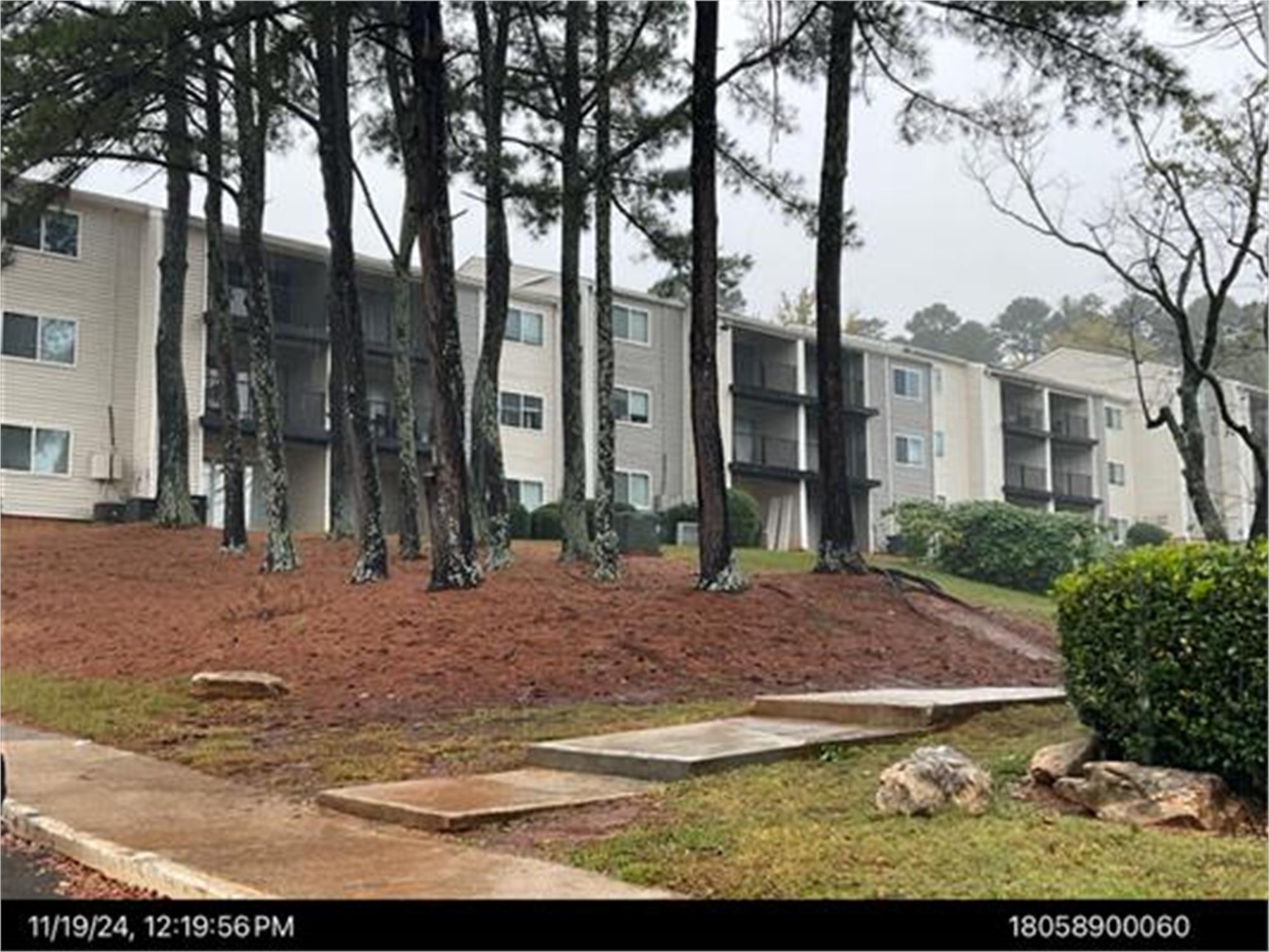
648 Whisper Ln, Austell, GA 30168-7104 · Cobb County
Awaiting outcome · Sale date November 3, 2026 · result pending
Subscribers get the latest updates, owner information including mailing address, tax card links, and the option to create instant property alerts.
Loading Street View...
For this property only. Prepared by our title team and emailed to you.
An illustrative scenario from your assumptions, not an estimate for this property.
Profit as a percentage of the total cost of the deal, earned over the 180-day hold. Not a yearly rate.
Example values, not estimates for this property.
Maximum bid for this scenario
$165,183
The highest bid that still returns 20% on all-in cost under the assumptions below. Higher repairs or a higher target lower it.
Demonstration values, not typical costs or this property's. Subscribers set their own in the full worksheet.
NOTICE OF SALE UNDER POWER Under and by virtue of the power of sale contained in the Deed to Secure Debt, Assignment of Leases and Rents, Security Agreement and Fixture Filing executed by 648 WHISPER LN PROPERTY, LLC, a Delaware limited liability company (the ?Grantor?) in favor of READYCAP COMMERCIAL, LLC, a Delaware limited liability company (the ?Original Grantee?), which was recorded on September 26, 2022 in the records of the Superior Court Clerk of Cobb County, Georgia, in Deed Book 16089, Page 5194; as assigned to READYCAP WAREHOUSE FINANCING, LLC, a Delaware limited liability company, by assignment recorded on September 26, 2022 in Deed Book 16089, Page 5544, aforesaid records; as assigned to READY CAPITAL MORTGAGE DEPOSITOR II, LLC, a Delaware limited liability company, by assignment recorded on June 6, 2023 in Deed Book 16138, Page 4314, aforesaid records; as assigned to READY CAPITAL SUBSIDIARY REIT II, LLC, a Delaware limited liability company, by assignment recorded on December 18, 2023 in Deed Book 16177, Page 4375, aforesaid records; as assigned to READY CAPITAL MORTGAGE DEPOSITOR IX, LLC, a Delaware limited liability company, by assignment recorded on January 11, 2024 in Deed Book 16181, Page 6475, aforesaid records; as assigned to READY CAPITAL MORTGAGE FINANCING 2023-FL11, LLC, a Delaware limited liability company, by assignment recorded on January 24, 2024 in Deed Book 16183, Page 4192, aforesaid records; as assigned to RCSR II NM, LLC, a Delaware limited liability company (?Grantee?), by assignment recorded on March 30, 2026 in Deed Book 16351, Page 849, aforesaid records; as affected by Partial Lien Release between READY CAPITAL MORTGAGE FINANCING 2023-FL11, LLC and 648 WHISPER LN PROPERTY, LLC, recorded on April 2, 2024 in Deed Book 16196, Page 4373, aforesaid records; as affected by Scrivener's Affidavit recorded on April 12, 2024 in Deed Book 16199, Page 854, aforesaid records; as affected by Partial Lien Release between READY CAPITAL MORTGAGE FINANCING 2023-FL11, LLC and 648 WHISPER LN PROPERTY, LLC, recorded on April 18, 2024 in Deed Book 16200, Page 2387, aforesaid records (collectively, as assigned, the ?Security Deed?), which Security Deed secures certain indebtedness and obligations of Grantor due and owing to Grantee, including, without limitation, the obligations of Grantor under that certain Promissory Note dated September 21, 2022, in the original principal amount of THIRTY-SIX MILLION FIVE HUNDRED THOUSAND AND 00/100 DOLLARS ($36,500,000.00) in favor of and payable to the order of READYCAP COMMERCIAL, LLC, a Delaware limited liability company, as lender (as subsequently endorsed and assigned to Grantee, the ?Note?), there will be sold by the Grantee, as attorney-in-fact for the Grantor, at public outcry to the highest bidder for cash before the courthouse door in Cobb County, Georgia, within the legal hours of sale on the first Tuesday in November 2026 (November 3, 2026), the following described property informally known as 648 Whisper Lane, Austell, Georgia (the ?Property?): ALL THAT TRACT OR PARCEL OF LAND LYING AND BEING IN LAND LOT 589 OF THE 18TH DISTRICT, 2ND SECTION, COBB COUNTY, GEORGIA, AND BEING MORE PARTICULARLY DESCRIBED AS FOLLOWS: BEGINNING AT A POINT LOCATED ON THE SOUTHERLY RIGHT-OF-WAY LINE OF SIX FLAGS DRIVE (80-FOOT RIGHT-OF-WAY), SAID POINT BEING 302.97 FEET EASTERLY FROM THE INTERSECTION OF SAID SOUTHERLY RIGHT-OF-WAY LINE OF SIX FLAGS DRIVE AND THE EASTERLY RIGHT-OF-WAY LINE OF FACTORY SHOALS ROAD (VARIABLE RIGHT-OF-WAY); THENCE RUNNING ALONG SAID SOUTHERLY RIGHT-OF-WAY LINE OF SIX FLAGS DRIVE SOUTH 73?24'29? EAST A DISTANCE OF 489.20 FEET TO A POINT; THENCE LEAVING SAID RIGHT-OF-WAY LINE AND RUNNING SOUTH 02?12'47? WEST A DISTANCE OF 924.12 FEET TO A CONCRETE RIGHT-OF-WAY MONUMENT LOCATED ON THE NORTHERLY RIGHT-OF-WAY OF INTERSTATE HIGHWAY NO. 20; THENCE RUNNING ALONG SAID NORTHERLY RIGHT-OF-WAY LINE OF INTERSTATE HIGHWAY NO. 20 THE FOLLOWING FOUR COURSES AND DISTANCES: SOUTH 87?25'14? WEST A DISTANCE OF 468.16 FEET TO A CONCRETE RIGHT-OF-WAY MONUMENT; NORTH 71?18'00? WEST A DISTANCE OF 541.57 FEET TO AN IRON PIN FOUND; NORTH 77?26'00? WEST A DISTANCE OF 164.40 FEET TO AN IRON PIN PLACED; AND NORTH 88?03'51? WEST A DISTANCE OF 165.22 FEET TO A CONCRETE RIGHT-OF-WAY MONUMENT LOCATED AT THE INTERSECTION OF THE NORTHERLY RIGHT-OF-WAY LINE OF INTERSTATE HIGHWAY NO. 20 AND THE COMMON BOUNDARY LINE OF LAND LOTS 588 AND 589, SAID DISTRICT AND COUNTY; THENCE LEAVING SAID RIGHT-OF-WAY LINE AND RUNNING ALONG SAID COMMON BOUNDARY LINE OF LAND LOTS 588 AND 589 NORTH 02?21'36? EAST A DISTANCE OF 189.30 FEET TO AN IRON PIN FOUND LOCATED ON THE SOUTHEASTERLY RIGHT-OF-WAY LINE OF FACTORY SHOALS ROAD (VARIABLE RIGHT-OF-WAY); THENCE RUNNING ALONG SAID SOUTHEASTERLY RIGHT-OF-WAY LINE OF FACTORY SHOALS ROAD THE FOLLOWING FOUR COURSES AND DISTANCES: NORTH 49?12'55? EAST A DISTANCE OF 317.56 FEET TO A POINT; ALONG THE ARC OF A CIRCULAR CURVE TO THE LEFT HAVING A RADIUS OF 1023.357 FEET AND AN ARC DISTANCE OF 21.24 FEET (SAID ARC BEING SUBTENDED BY A CHORD BEARING NORTH 48?37'14? EAST A CHORD DISTANCE OF 21.24 FEET) TO AN IRON PIN PLACED; NORTH 41?58'26? WEST A DISTANCE OF 10.00 FEET TO AN IRON PIN PLACED; AND ALONG THE ARC OF A CIRCULAR CURVE TO THE LEFT HAVING A RADIUS OF 1013.357 FEET AND AN ARC DISTANCE OF 187.79 FEET (SAID ARC BEING SUBTENDED BY A CHORD BEARING NORTH 42?43'01? EAST A CHORD DISTANCE OF 187.52 FEET) TO AN IRON PIN PLACED; THENCE LEAVING SAID RIGHT-OF-WAY LINE AND RUNNING SOUTH 26?56'36? EAST A DISTANCE OF 284.01 FEET TO AN IRON PIN FOUND; THENCE RUNNING NORTH 42?38'48? EAST A DISTANCE OF 310.90 FEET TO AN IRON PIN FOUND; THENCE RUNNING NORTH 22?31'37? EAST A DISTANCE OF 200.02 FEET TO AN IRON PIN FOUND; THENCE RUNNING NORTH 22?55'08? EAST A DISTANCE OF 225.50 FEET TO A POINT LOCATED ON THE SOUTHERLY RIGHT-OF-WAY LINE OF SIX FLAGS DRIVE AND THE POINT OF BEGINNING; SAID PROPERTY CONTAINING 21.018 ACRES. NOTE FOR INFORMATION: Being Tax Parcel No. 18058900060, Cobb County, Georgia. The real property described in this Notice of Sale Under Power is referred to herein as the ?Land?, and is being sold with all other property described in the paragraph that begins on the page of the Security Deed with the number 1 in the bottom centered with ?[t]o secure the full and timely payment? and concludes on the page of the Security Deed with the number 2 in the bottom centered stating ?and all other property which is or hereafter may become subject to a Lien in favor of Lender pursuant to any Loan Document.? All capitalized terms used but not defined in this notice have the meanings ascribed to such terms in the Security Deed. Each person bidding for the Property will be asked to identify the portion of his or her bid price attributable to the portion of the Property constituting a real property interest under Georgia law, and that portion of his or her bid price attributable to the portion of the Property constituting personal property under Georgia law. Grantor defaulted under the terms of the Note and Security Deed by failing to timely pay the amounts due thereunder, among other things. The entire outstanding principal sum evidenced by the Note, together with all accrued but unpaid interest thereon, is now due and payable. The Note remaining in default, the above sale will be made for the purpose of applying the proceeds to the payment of the Note, accrued interest thereon through the date of sale, all expenses of the sale, and all other payments provided for under the Note and the Security Deed and by law, and the remainder of such proceeds, if any, shall be applied as provided by law. To the best of the undersigned's knowledge and belief, Grantor and/or its tenant(s) are the party / parties in possession of the Property. The Property will be sold as the property of Grantor, subject to any unpaid ad valorem taxes and governmental assessments (including taxes which are a lien, but not yet due and payable); zoning ordinances and governmental restrictions; the rights of tenants under written leases that are not then in default; and any liens, restrictions, covenants, rights-of-way, easements, leases, declarations, and other encumbrances that appear of record prior to the Security Deed. RCSR II NM, LLC is the Grantee under the Security Deed, the secured creditor, and the holder of the Note. The entity that has full authority to negotiate, amend, and modify all terms of the Security Deed with the debtor is RCSR II NM, LLC, c/o Ready Capital, 200 Connell Drive, Suite 4000, Berkeley Heights, New Jersey 07922, Attention: Jonathan Kohan, (332) 345-4834. Please understand that the secured creditor is not required to negotiate, amend, or modify the terms of the Security Deed. RCSR II NM, LLC as Attorney-in-Fact for Grantor Christopher H. Ezell Holland & Knight LLP 701 Brickell Avenue Suite 3300 Miami, Florida 33131 (305) 789-7592 10:9,16,23,30-2026
Recorded from 1 source. First recorded October 9, 2026. Record as of October 25, 2026. About this data & licence
Subscribers see this record 14 days earlier, plus the owner of record and mailing address.
Title Reports need only a free account.