Public record · 14-day delayAbout our data
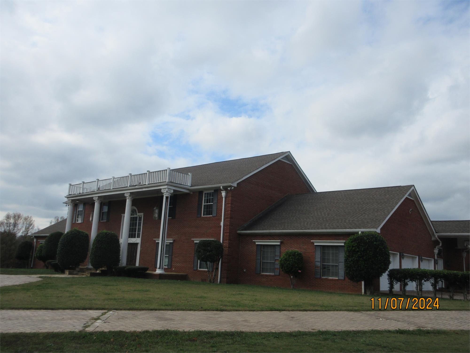
5839 Reeds Bridge Rd, Ringgold, GA 30736-5312 · Catoosa County
No outcome reported · Sale date October 6, 2026 · no outcome reported
Subscribers get the latest updates, owner information including mailing address, tax card links, and the option to create instant property alerts.
Loading Street View...
For this property only. Prepared by our title team and emailed to you.
An illustrative scenario from your assumptions, not an estimate for this property.
Profit as a percentage of the total cost of the deal, earned over the 180-day hold. Not a yearly rate.
Example values, not estimates for this property.
Maximum bid for this scenario
$165,183
The highest bid that still returns 20% on all-in cost under the assumptions below. Higher repairs or a higher target lower it.
Demonstration values, not typical costs or this property's. Subscribers set their own in the full worksheet.
Notice of Sale Under Power GEORGIA, CATOOSA COUNTY. THIS LAW FIRM IS ACTING AS A DEBT COLLECTOR ATTEMPTING TO COLLECT A DEBT. ANY INFORMATION OBTAINED WILL BE USED FOR THAT PURPOSE. Under and by virtue of the Power of Sale contained in that Security Deed given by KENNETH J. MACE a/k/a JAY MACE, resident of the State of Georgia (the "Borrower"), to SMARTBANK (the "Lender"), dated June 8, 2018, and recorded on June 18, 2018, in Book 1940, Pages 599 in the Office of the Catoosa County, Georgia Superior Court Clerk, as modified by that Modification of Security Deed from Borrower to Lender dated January 14, 2020, and recorded February 12, 2020, in Book 2034, Page 114, in the said Clerk's Office (collectively, the "Security Deed"), conveying the property therein described to secure, among other indebtedness, a Credit Agreement and Disclosure dated June 8, 2018, in the original principal amount of Nine Hundred and Thirty Thousand and 00/100 Dollars ($930,000.00), executed by Borrower in favor of Lender (as modified or amended, the "Credit Agreement"), with interest thereon as set forth therein, there will be sold at public outcry to the highest bidder for cash before the courthouse door of Catoosa County, Georgia, within the legal hours of sale on the first Tuesday in October, 2026 the following described property known as 5839 Reeds Bridge Road, Ringgold, GA 30736. All that tract or parcel of land and lying and being in original Land Lot 128, 160, and 161 in the 9th District and 4th Section of Catoosa County, Georgia, being described as follows: Beginning at a point on the south line of original Land Lot 128, a distance of 1,238.8 feet west, as measured along the south line of original Land Lot no. 128 from its intersection with the west line of Burning Bush Road; thence leaving the Land Lot line and running south 5 Degrees 39 Minutes west, a distance of 724.08 feet to a point; thence south 21 Degrees 41 Minutes west 970 feet, more or less, to the center line of Chickamauga Creek; thence running in a westerly and northwesterly direction, along the center line of the Creek a distance of 3,235 feet, more or less, to a point; thence south 86 Degrees 7 Minutes 7 Seconds east, a distance of 2,704.6 feet to a point; thence north a distance of 450 feet; more or less, to the line dividing land lots 161 and 128; thence north 89 Degrees east along said dividing line, a distance of 147.70 feet to point; thence, north 7 Degrees 8 Minutes 22 Seconds east a distance of 535.73 feet to the south line of Boynton Drive; thence north 22 Degrees 14 Minutes 15 Seconds east 15 feet to the south line of Boynton Drive, after it has narrowed; thence south 67 Degrees 45 Minutes 45 Seconds east, along the south line of Boynton Drive, a distance of 217.45 feet to a point; thence leaving Boynton Drive and running south 21 Degrees 37 Minutes 42 Seconds west a distance of 192.70 feet to a point; thence south 68 Degrees 51 Minutes 38 Seconds east a distance of 169.8 feet to a point; thence south 21 Degrees 0 Minutes west a distance of 226.99 feet to the point of beginning. Less and except that portion of property conveyed in Deed Book 532, page 449 and Tract #4 of Deed Book 680, page 20 in the Office of the Clerk of the Superior Court of Catoosa County, Georgia. For prior title see that Warranty Deed dated December 16, 2013, and recorded in Book 1709, Page 367, in the Office of the Clerk of the Superior Court of Catoosa County, Georgia. SUBJECT TO: A Federal Tax Lien in the amount of $33,790.51, recorded June 14, 2018, in Book 98, Page 993, in the Office of the Clerk of the Superior Court of Catoosa County, Georgia. A Security Deed from Kenneth Jay Mace a/k/a Jay Mace to SmartBank, in the original principal amount of $930,000.00, dated June 8, 2018, and recorded June 18, 2018, in Book 1940, Page 599, in the Office of the Clerk of the Superior Court of Catoosa County, Georgia. A Modification of Security Deed from Kenneth Jay Mace a/k/a Jay Mace to SmarkBank, in the increased principal amount of $991,000.00 dated January 14, 2020, and recorded February 12, 2020, in Book 2034, Page 114, in the Office of the Clerk of the Superior Court of Catoosa County, Georgia. A Federal Tax Lien in the amount of $62,462.84, recorded October 13, 2022, in Book 117, Page 804, in the Office of the Clerk of the Superior Court of Catoosa County, Georgia. A Georgia Department of Revenue State Tax Execution in the amount of $7,879.71, recorded May 24, 2022, in Book 116, Page 133, in the Office of the Clerk of the Superior Court of Catoosa County, Georgia. A Georgia Department of Revenue State Tax Execution in the amount of $33,443.51, recorded on September 25, 2025, in Book 129, Page 722, in the Office of the Clerk of the Superior Court of Catoosa County, Georgia. A Lis Pendens recorded on March 22, 2011, in Lien Book 59, Page 743, in the Office of the Clerk of the Superior Court of Catoosa County, Georgia. The Lis Pendens was never released despite the underlying litigation being dismissed without prejudice, on or about December 16, 2011. An Application and Questionnaire for Current Use Assessment of Bona Fide Agricultural Property filed on November 21, 2024, in Book 2358, Page 359, in the Office of the Clerk of the Superior Court of Catoosa County, Georgia. Georgia Power Company right of way as set forth in Deed Book 30, Page 72, in said Clerk's Office. Natural Gas Company right of way as set forth in Deed Book 36, Page 365, in said Clerk's Office. 2025 Catoosa County property taxes ARE DELINQUENT in the estimated amount of $7,986.30, subject to any additional interest and penalties accrued by the time of closing. Tax Map No.: 0014A-032-00A The debt secured by the Security Deed has been and is hereby declared due because of, among other possible events of default, failure to pay the indebtedness as and when due and in the manner provided in the Credit Agreement and the Security Deed. The debt remaining in default, this sale will be made for the purpose of paying the same and all expenses of this sale, as provided in the Security Deed and by law, including attorneys fees (notice of intent to collect attorney's fees having been given). Said property will be sold subject to any outstanding ad valorem taxes (including taxes which are a lien, but not yet due and payable), any matters which might be disclosed by an accurate survey and inspection of the property, any assessments, liens, encumbrances, zoning ordinances, restrictions, covenants, and matters of record superior to the Security Deed first set out above. Said property also sold subject to the rights of tenant(s) in possession, if any, and all parties claiming by, through or under said tenant(s). The sale will be conducted subject to (1) confirmation that the sale is not prohibited under the U.S. Bankruptcy Code; and (2) final confirmation and audit of the status of the loan with the holder of the Security Deed. To the best knowledge and belief of the undersigned, the party in possession of the property is Kenneth Jay Mace a/k/a Jay Mace or other tenant or tenant(s), and said property is more commonly known as 5839 Reeds Bridge Rd., Ringgold, GA 30736. Additional Parties that may be entitled to Notice: Internal Revenue Service Georgia Department of Revenue SMARTBANK, as Attorney in Fact for KENNETH JAY MACE a/k/a JAY MACE. Contact: Chambliss, Bahner & Stophel, P.C., ATTN: Alexander B. Blankers, 605 Chestnut Street, Suite 1700, Liberty Tower, Chattanooga, Tennessee 37450 (423) 756-3000. 9:9,16,23,30,2026
Recorded from 1 source. First recorded September 9, 2026. Record as of October 26, 2026. About this data & licence
Subscribers see this record 14 days earlier, plus the owner of record and mailing address.
Title Reports need only a free account.