Public record · 14-day delayAbout our data
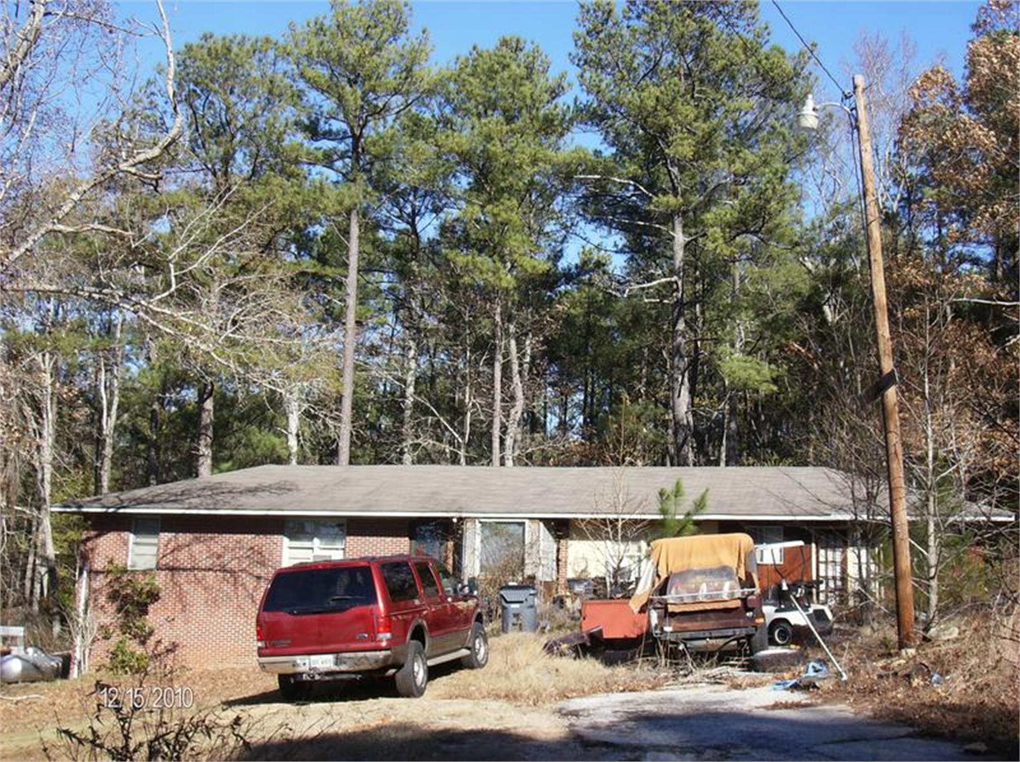
5210 Guthrie Cemetery Rd, Loganville, GA 30052-4469 · Walton County
Cancelled · Was scheduled for June 2, 2026
Subscribers get the latest updates, owner information including mailing address, tax card links, and the option to create instant property alerts.
Loading Street View...
For this property only. Prepared by our title team and emailed to you.
An illustrative scenario from your assumptions, not an estimate for this property.
Profit as a percentage of the total cost of the deal, earned over the 180-day hold. Not a yearly rate.
Example values, not estimates for this property.
Maximum bid for this scenario
$165,183
The highest bid that still returns 20% on all-in cost under the assumptions below. Higher repairs or a higher target lower it.
Demonstration values, not typical costs or this property's. Subscribers set their own in the full worksheet.
"Notice of Sale Under Power Georgia, WALTON County Under and by virtue of the Power of Sale contained in a Deed to Secure Debt given by ANDRES AVILA JR AND ANA M DOMINGUEZ ARTEAGA to MORTGAGE ELECTRONIC REGISTRATION SYSTEMS, INC. AS NOMINEE FOR US MORTGAGE CORPORATION, ITS SUCCESSORS AND ASSIGNS, dated March 28, 2023, and recorded in Deed Book 5293, Page 403 , WALTON County, Georgia records, as last transferred to Planet Home Lending, LLC., by assignment recorded in Deed Book 5625, Page 847, in the Office of the Clerk of WALTON County, Georgia Records, conveying the after-described property to secure a Note of even date in the original principal amount of $279,837.00, with interest at the rate specified therein, there will be sold by the undersigned at public outcry to the highest bidder for cash before the Courthouse door of WALTON County, Georgia, within the legal hours of sale on the first Tuesday in June, 2026, to wit: June 2, 2026, the following described property: ALL THAT TRACT OF PARCEL OF LAND LYING AND BEING IN BROKEN ARROW MILITIA DISTRICT OF WALTON COUNTY, GEORGIA, ACCORDING TO PLAT AND SURVEY BY WILLIAM J. GREGG, SR., SURVEYOR, DATED MAY 15, 1967, AND RECORDED IN PLAT BOOK 13, PAGE 127, CLERK'S OFFICE, WALTON SUPERIOR COURT, AND BEING MORE PARTICULARLY DESCRIBED AS FOLLOWS: BEGINNING AT AN IRON PIN ON THE NORTHEASTERLY SIDE OF A DIRT ROAD (RUNNING BETWEEN HIGHWAY NO. 138 AND OLD CONYERS ROAD) SIX HUNDRED TWENTY-FIVE AND SEVEN TENTHS (625.7) FEET NORTHWESTERLY AS MEASURED ALONG SAID DIRT ROAD FROM THE COMER FORMED BY THE INTERSECTION OF THE NORTHEASTERLY SIDE OF SAID DIRT ROAD AND THE NORTHERLY SIDE OF HIGHWAY NO. 138 (130 FOOT RIGHT-OF WAY); SAID POINT OF BEGINNING ALSO BEING THE NORTHWESTERLY LINE OF PROPERTY NOW OR FORMERLY OWNED BY J. E. SMITH; THENCE RUNNING NORTH 32 DEGREES 30 MINUTES WEST, ALONG THE NORTHEASTERLY SIDE OF SAID DIRT ROAD, TWO HUNDRED EIGHT AND FIVE TENTHS (208.5) FEET TO AN IRON PIN ON THE SOUTHEASTERLY LINE OF PROPERTY NOW OF FORMERLY OWNED BY R. T. SMITH; THENCE NORTH 57 DEGREES 00 MINUTES EAST ALONG THE SOUTHEASTERLY LINE OF SAID R. T. SMITH PROPERTY, TWO HUNDRED EIGHT AND FIVE TENTHS (208.5) FEET TO AN IRON PIN ON THE SOUTHWESTERLY LINE OF THE ABOVE MENTIONED J. B. SMITH PROPERTY; THENCE SOUTH 32 DEGREES 30 MINUTES EAST, ALONG THE SOUTHWESTERLY LINE OF SAID J. E. SMITH PROPERTY, TWO HUNDRED EIGHT AND FIVE TENTHS (208.5) FEET TO AN IRON PIN ON THE NORTHWESTERLY LINE OF THE ABOVE MENTIONED J. E. SMITH PROPERTY; THENCE SOUTH 57 DEGREES 00 MINUTES WEST ALONG THE NORTHWESTERLY LINE OF SAID, J. E. SMITH PROPERTY, TWO HUNDRED EIGHT AND FIVE TENTHS (208.5) FEET TO AN IRON PIN ON THE NORTHEASTERLY SIDE OF SAID DIRT ROAD AND THE POINT OF BEGINNING. THIS DEED IS MADE SUBJECT TO ALL RESTRICTIVE COVENANTS OF RECORDS EXCEPT THOSE WHICH IMPOSE A RESTRICTION UPON THE SALE OR OCCUPANCY OF THE ABOVE DESCRIBED PROPERTY ON THE BASIS OF RACE, COLOR, OR CREED. TAX ID#: C0530-00000-064-000 SUBJECT TO ANY EASEMENTS OR RESTRICTIONS OF RECORD The debt secured by said Deed to Secure Debt has been and is hereby declared due because of, among other possible events of default, failure to pay the indebtedness as and when due and in the manner provided in the Note and Deed to Secure Debt. The debt remaining in default, this sale will be made for the purpose of paying the same and all expenses of this sale, as provided in the Deed to Secure Debt and by law, including attorney's fees (notice of intent to collect attorney's fees having been given). Said property is commonly known as 5210 GUTHRIE CEMETERY RD, LOGANVILLE, GEORGIA 30052, together with all fixtures and personal property attached to and constituting a part of said property. To the best knowledge and belief of the undersigned, the party (or parties) in possession of the subject property is (are): by ANDRES AVILA JR AND ANA M DOMINGUEZ ARTEAGA or tenant or tenants. Said property will be sold subject to (a) any outstanding ad valorem taxes (including taxes which are a lien, but not yet due and payable), (b) any matters which might be disclosed by an accurate survey and inspection of the property, and (c) all matters of record superior to the Deed to Secure Debt first set out above, including, but not limited to, assessments, liens, encumbrances, zoning ordinances, easements, restrictions, covenants, etc. The sale will be conducted subject to (1) confirmation that the sale is not prohibited under the U.S. Bankruptcy Code; (2) O.C.G.A. Section 9-13-172.1; and (3) final confirmation and audit of the status of the loan with the holder of the security deed. Pursuant to O.C.G.A. Section 9-13-172.1, which allows for certain procedures regarding the rescission of judicial and non-judicial sales in the State of Georgia, the Deed Under Power and other foreclosure documents may not be provided until final confirmation and audit of the status of the loan as provided in the preceding paragraph. Pursuant to O.C.G.A. Section 44-14-162.2, the entity that has full authority to negotiate, amend and modify all terms of the mortgage with the debtor is: Planet Home Lending, LLC Attention: Loss Mitigation Department 321 Research Parkway, Suite 303 Meriden, CT 06450 (855) 884-2250 The foregoing notwithstanding, nothing in OC.G.A. Section 44-14-162.2 shall be construed to require the secured creditor to negotiate, amend or modify the terms of the Deed to Secure Debt described herein. This sale is conducted on behalf of the secured creditor under the power of sale granted in the aforementioned security instrument, specifically being Planet Home Lending, LLC. as attorney in fact for ANDRES AVILA JR AND ANA M DOMINGUEZ ARTEAGA Kahane & Associates, P.A. 180 Interstate N Parkway, Suite 200 Atlanta, Georgia 30339 Telephone: (404) 252-6385 File No.: 26-00792 THIS LAW FIRM IS ACTING AS A DEBT COLLECTOR ATTEMPTING TO COLLECT A DEBT. ANY INFORMATION OBTAINED WILL BE USED FOR THAT PURPOSE. 1607"
Recorded from 3 sources. First recorded May 4, 2026. Record as of October 25, 2026. About this data & licence
Subscribers see this record 14 days earlier, plus the owner of record and mailing address.
Title Reports need only a free account.